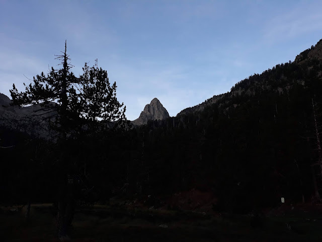
Pic Quayrat -cara oeste-.
És viernes 8 de julio de 2012 y después de la pequeña decepción del Arbizon, pensamos que la mejor manera de volver a coger motivaciones era plantearse otro objetivo de similares dimensiones.
Otra gran vía de los hermanos Ravier, para quitarnos los complejos y frustraciones…
Aunque en esta ocasión la escalada nos dejaría un intenso recuerdo… Unos cuantos valles hacia el este del valle de Campan, se encuentra el valle d’Astau –cerca de Bagneres de Luchon-.
Llegamos hasta las Granjes d’Astau -1400 m- y la meteo no pintaba nada buena; ascendimos por el valle bajo una intensa lluvia y tormenta eléctrica, que nos dejó totalmente mojados.
Pasamos por el Lac D’Oô y después alcanzamos el refugio d’Espingo -1950 m- donde nos alojamos y secamos la ropa. La lluvia de la llegada al refugio me traía el recuerdo de dos años atrás junto a dos amigos –Pedro Millán y Ricard Avila- donde acometimos las crestas de la Seil de la Vaque y Lezat. Pensé que tal vez en esta ocasión tendríamos la misma suerte.
Amaneció totalmente cubierto de niebla y todo aún mojado. Remontamos el camino dirección al Lac du Portillón con bastante frío para la época, aunque dejamos atrás la niebla, el cielo estaba cubierto y la progresión de las nubes era constante. Antes de llegar al refugio Jean Arlaud, giramos a la izquierda para remontar por las laderas del Quayrat y alcanzar el comienzo de la vía, identificada por una fisura negra a la derecha de una lámina fina de color rojo y de grandes proporciones –definición de la reseña, pero que cuesta identificar-.
Comenzamos los largos de cuerda, con ambiente frío, viento y la roca mojada por la lluvia, pero con la fuerte convicción de que esta vez si que íbamos para arriba. Los largos se suceden y vamos encontrando algún viejo pitón y alguna reunión –solo dos-. Las dificultades son del estilo ya conocido y hay que equipar prácticamente de nuevo todo los largos. Las horas pasan y al final de la vía salimos por un espolón que no identificamos con la reseña que llevamos. Aún así seguimos para arriba con ganas de llegar a la cumbre del Quayrat -3060 m-. Estos últimos largos de cuerda son de IV, y ya son las nueve de la noche cuando hacemos cima. Todo nos hace pensar que nos va caer un vivac en el descenso. No hacemos prácticamente fotos y corremos literalmente por la arista norte –vía normal- que no es especialmente un camino.
Llegamos a un caos de bloques y la oscuridad cae de golpe y perdemos cualquier referencia posible para continuar descendiendo con seguridad hasta el refugio d’Espingo. Intuimos por el mapa que el descenso flanquea toda la falda del Quayrat, que está rodeada de fuertes cortados, para llegar prácticamente al refugio, pero la falta de visión nos hace aplicar el sentido común y buscar un lugar para pasar la noche.
Unas rocas nos valen de refugio, estiramos las cuerdas y material, y nos protegemos del viento y frío de la noche con toda la ropa que llevamos y comemos un par de barritas como única cena. No es que hayamos sido especialmente lentos, pero estas ascensiones son así, donde la incertidumbre del itinerario, el equipamiento precario y la austeridad del entorno son agentes que acompañan toda la ascensión y son la componente que hacen realmente atractiva y valorada este tipo de escaladas.
Las horas se hacen muy largas y la noche es fría. Vamos dando alguna que otra cabezada, pero de seguida algún que otro tiritón nos despierta, y hablamos para distraernos pensando que así pasará antes el tiempo. Aún así estamos contentos de la actividad en nuestro improvisado vivac de fortuna. Las horas pasan y por fin, después de una larga noche, comienzan a llegar las primeras luces del amanecer, con los cuerpos entumecidos por el frío y las rocas que no han dejado de clavarse en nuestras espaldas. Nos incorporamos y comenzamos el descenso hasta el refugio.
Bibliografia: Bellefon, P. (1977). Los Pirineos. Las 100 mejores ascensiones y excursiones. “Ascensión nº85”. Editorial R.M. Barcelona.
Mapa Bagneres de Luchon. Carta IGN 1848 OT. Esditorial IGN. France.
Desnivel: 500 m
Dificultad: MD, con pasos de V+. Pared de granito vertical con posibilidad de escapatoria por otros itenerarios.
Material: 15 cintas, 4 pintones planos y 3V -recomendables pitones planos-, juego de friends –los grandes no són necesarios-, juego tascones y diversos anillos.
Horario: 10 h (la reseña marca entre 7-8h).
Aproximación: 3h desde el refugio d’Espingo o 1h desde el refuigo Jean Arlaud.
Itinerario: Entre los dos resaltes de la pared oeste del Quayrat.
Josep Cabo y Ciscu Carmona


 |
| Cara O Quayrat |
 |


Comentaris
Enhorabuena por la actividad y el espíritu.